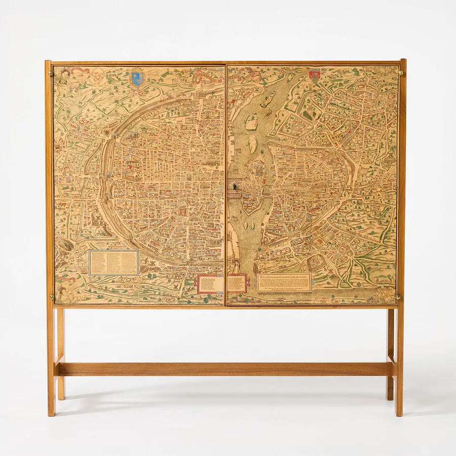
I have always loved maps, and I like sifting through online auction catalogues for old pieces of furniture. So when I, in the middle of October 2026, stumbled upon this fantastic cabinet by Josef Frank with a map of Paris I had never seen, I went down a rabbit hole.
The map itself was extraordinary. The colours, the details, the history of how it was found. I looked at it for hours, trying to locate places I knew, imagining what they would have looked like back then.
But the rabbit hole took me even further. The artists behind the map - Olivier Truschet and Germain Hoyau - lived on the same street in Paris that I used to live. Probably within a few hundred metres (see more on the exact location further down).
When I realised, I knew I had to do something about it.
I couldn’t afford to buy the cabinet, so instead I built this site.
Here I explain how I, with the help of Claude Code, laid the two maps together. That was the easy part.
What took time was looking up all the named places - I wanted to have facts on all of them.
I’m still building the repository of open source material to fill in details (see it here), but every location now has at least some facts, even if, in some cases, they come only from Wikipedia.
I’ll keep expanding on the facts and collecting sources, so if you have suggestions on further reading or additional sources, please feel free to drop me a line.
And if you find something that is incorrect or plainly wrong, please let me know.
– Peer Blekelj
Get in touch
A bird's-eye view
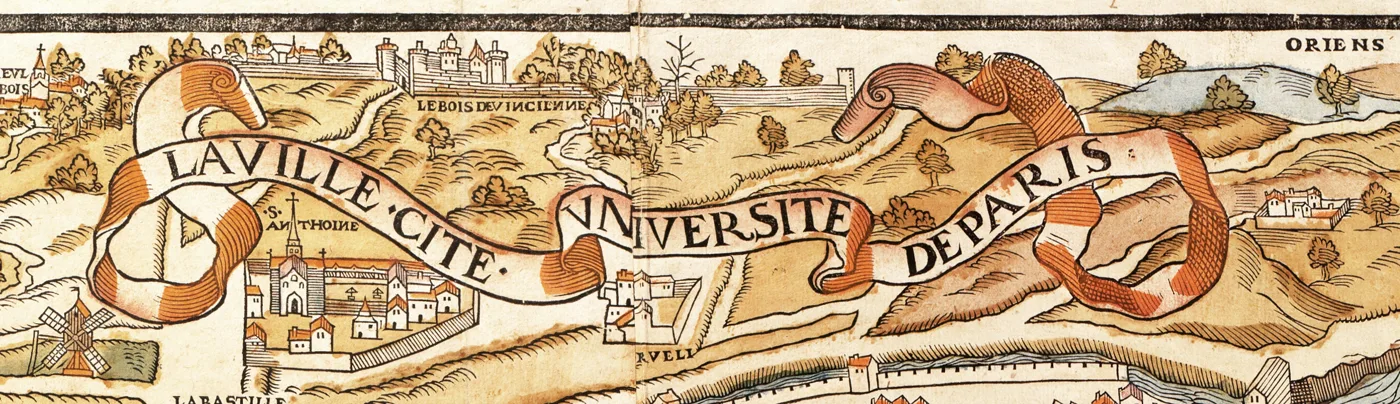
A scrolling ribbon across the top bears the title: La Ville, Cité et Université de Paris, naming the capital's three traditional quarters. Printed from eight woodblocks on eight pasted sheets of paper, the complete sheet measures about 133 cm wide by 96 cm high [1][3]. Jules Cousin, the first scholar to examine the surviving Basel copy, described its hand colouring as “richly, too richly” done [1].
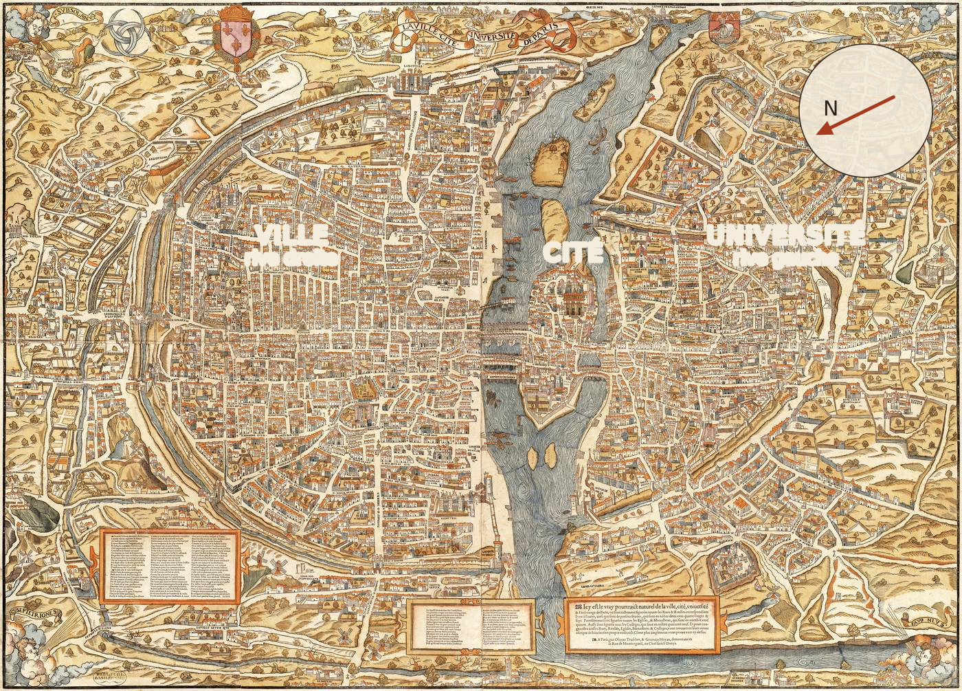
The map shows Paris from high above the west looking east. East sits at the top, flanked by four blowing winds in the corners naming the cardinal directions, and north is on the left.
One consequence: the Right Bank is not on the right. Banks are named as you look downstream, and the Seine flows west, so the right bank is the north bank. On this map north is on the left, so the rive droite, the Ville, fills the left half of the sheet, and the rive gauche, the Université, the right half. The Cité, the island, lies between them.
Prominent monuments stand in profile with recognizable architectural detail, while ordinary houses appear as repetitive rows of small gabled cottages [1].
The woodcutters bent geography to fit their rectangular frame. Downstream to the west, the Seine turns at an artificial right angle so both banks fit into view as far as Passy and Auteuil. Upstream to the east, the horizon drops sharply to squeeze in the Marne confluence and the villages of Vincennes, Conflans, Vitry, Villejuif, and Bicêtre [1].
Hundreds of street names carved into the wood between houses “swarm with mistakes”, as Cousin observed in 1875, whereas the text set in metal type within large cartouches is far more accurate [1]. Across the bottom runs a 108-line verse eulogy of Paris (read it in full, with a translation). A third cartouche proclaims the view Icy est le vray pourtraict naturel de la ville, cité, université et faubourgs de Paris (“here is the true and natural portrait…”), promising 287 streets and alleys, 104 churches and monasteries, and 49 colleges [1].
The printmakers
The cartouche at lower right carries the map's only signature: A Paris, par Olivier Truschet et Germain Hoyau, demourans en la rue de Montorgueil, au chef Sainct-Denys (“at Paris, by Olivier Truschet and Germain Hoyau, living in the rue Montorgueil, at the sign of the Head of Saint Denis”) [1]. These are the earliest publishers' names on any map of Paris.
Neither man was a bookseller. Cousin inferred from the word par (“by”) that they cut the woodblocks themselves, judging the cutting the work of a skilled craftsman rather than a true artist [1]. Modern accounts often split the labor. French Wikipedia and the Institut Paris Région describe Truschet as the draughtsman and Hoyau as the engraver [4][5], though another tradition reverses those roles. The print itself does not say who drew the view and who carved the wood.
Archival records trace both men. Truschet died in about 1561–1564, though an archbishop's rent roll listed him as late as 1575 [9]. Hoyau bought shares in the nearby Good Shepherd workshop in 1563 and 1566, where he signed religious prints with Mathurin Nicolas around 1572 [1][9]. Their original shop at the Head of Saint Denis stood nearby (below).
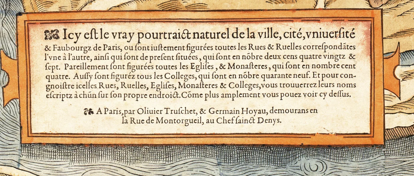
A third figure appears in the 108-line poem. The initial letters of its first fourteen lines spell out GILLES CORROSET, referring to Gilles Corrozet (1510–1568), bookseller at the Palais and civic historian [1][14]. The same acrostic opened Corrozet's 1532 Fleur des antiquités de Paris under the heading “Le nom et surnom de l'aucteur” [14], a label the map omits. Cousin was the first to point out the acrostic on the map, in 1875 [1]. We checked the rest of the poem and the publishers' notice and found no other acrostic (see the texts on the map).
The poem reprints Corrozet's “Louenges de Paris” from the Fleur, a book he later dismissed as full of errors and fables [1]. The map follows the verses almost word for word, omitting four lines and updating several figures, turning eleven gates into fourteen, thick walls into high ramparts, and one hundred councillors of the Parlement into six score [14].
From the acrostic Cousin concluded that Corrozet sponsored the map as a companion to his 1550 guidebook Les Antiquités de Paris, sold from his shop at the Palais [1]. That patronage remains an inference without documentary proof: the verses had been in print since 1532, and the map names only Truschet and Hoyau. The chief supporting evidence is the Basel copy itself, bought in Paris alongside the 1550 guidebook (below). French Wikipedia mentions a 1553 commission from Corrozet [4], citing p. 168 of Françoise Vergneault-Belmont's 2008 study Lire l'espace, penser la carte, but that is a modern study, not a document of the time.
The print shop
In 1550 the rue Montorgueil differed from the modern street. South of the rue Mauconseil ran the rue au Comte-d'Artois, labelled “R. Conte Dartois” on the woodcut [2]; that segment became part of the rue Montorgueil only in 1792 [17]. To the north, the street included today's rue des Petits-Carreaux, which became a separate street in the seventeenth century [17]. The Head of Saint Denis therefore stood between the rue Mauconseil and Charles V's defensive ditch, now followed by the rue d'Aboukir, within today's rue Montorgueil or rue des Petits-Carreaux.
Printmakers formed a dense cluster along this street. Cousin described an entire colony of image-makers [1]. By 1572 the Head of Saint Denis had passed to Nicolas Prévost, beside shops flying signs like the Chessboard, the Deer's Horn, and the Stag's Horn [1]. Séverine Lepape catalogues these workshops [15], and Marianne Grivel traces the nearby Good Shepherd house [16].
Which house it was, we do not know. We have found no study that connects the Head of Saint Denis or its neighbours' signs to a standing building, and we will not guess a street number. It could be found. The Good Shepherd house, at least, paid ground rent to the archbishop of Paris [9], and the archbishop's rent rolls (the censive) list houses street by street with their signs and owners. Followed forward from register to register, they lead to the late eighteenth-century parcel plans published by Armand Brette [18]. Deeds of sale, which name the neighbours on either side, can do the same. That is work for the Archives nationales. Our research notes are on GitHub. If you know more, please tell us.
Dating the map
The sheet carries no printed date. Cousin thought the publishers left it off deliberately to keep the map looking new as long as possible [1]. Dating depends on construction projects visible on the ground:
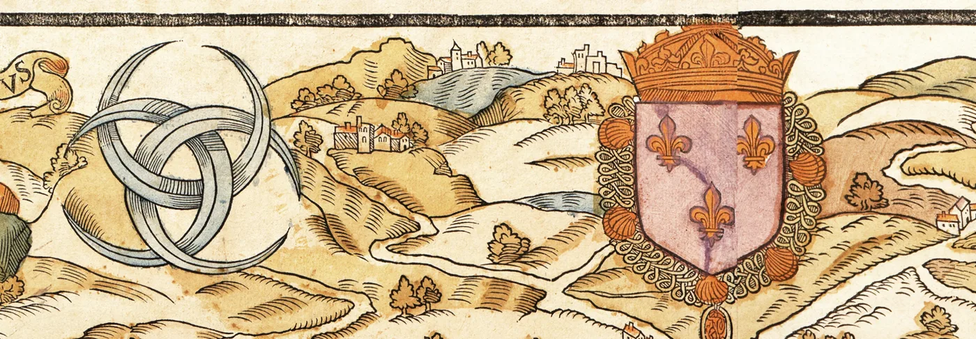
- Royal heraldry: Henri II's interlaced crescents place the view between 1547 and 1559.
- Built by 1550: The Pont Saint-Michel rebuilt with houses after falling in 1547, the royal Arsenal of 1549, the reopened Porte de Nesle, and the new quay at the Port au Foin.
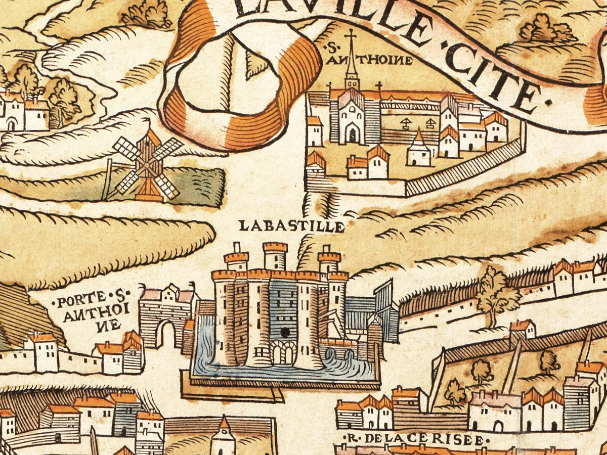
- Not yet built: The bastioned ditch between the Arsenal and the Bastille, begun in 1552; the uniform houses built on the Petit-Pont in 1552 (the map still shows older irregular dwellings); and the Marché Neuf.
- Festival decorations: The Ponceau fountain on the rue Saint-Denis still carries architectural dressings from Henri II's entry on 16 June 1549. Cousin reasoned that temporary decorations would survive only a winter or two.
These clues gave Cousin 1551 or 1552 [1], the date the Basel University Library retains in its catalogue [3].
Two major monuments complicate this picture. The Louvre appears as Philippe Auguste's medieval fortress with its central keep, though the keep was pulled down in 1529 as Renaissance wings arose. By contrast, the new Hôtel de Ville appears half-built, standing one storey high with a single corner pavilion [1]. Cousin explained that both sites were shrouded in scaffolding around 1550; the woodcutters drew the visible progress on the municipal hall and supplied the familiar old Louvre from memory [1].
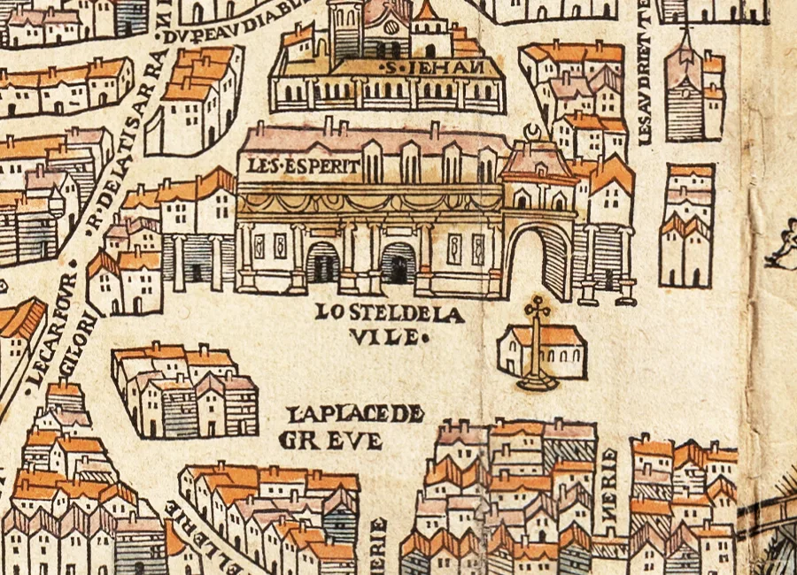
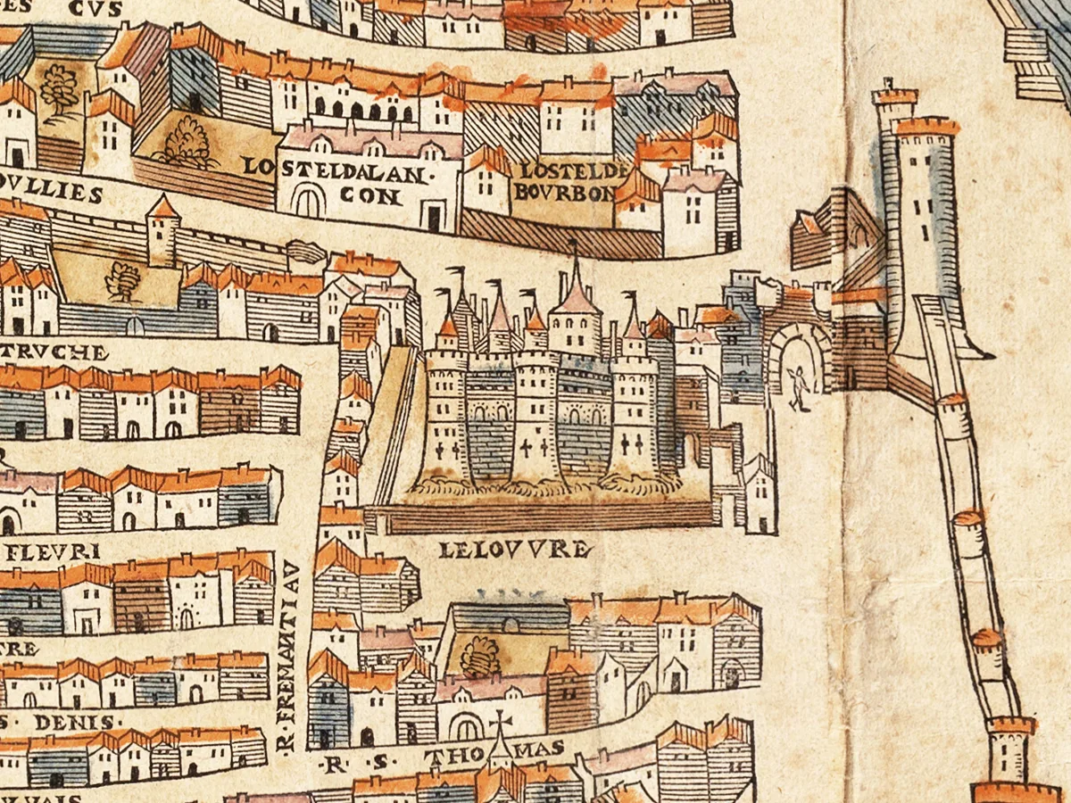
Modern scholars offer slightly different dates, ranging from “c. 1550” in the Basel catalogue and Wikimedia Commons [8], to “c. 1550–1552” from the Institut Paris Région [5], “1552 for the view, 1553 for the edition” on French Wikipedia [4], and about 1553 in Jean Boutier's catalogue of Paris plans [6]. These variants all capture Paris in the early reign of Henri II. This site adopts c. 1550.
Cousin also suggested the woodcut derived from an official survey ordered by Henri II on 8 September 1550 to record the city walls and suburbs [1]. Later historians have repeated this idea [4], but no such survey has been found.
Paris in 1550
The three parts named in the title form distinct sectors. La Ville on the right bank contains commercial life around the Halles markets, the Grève river port, and the Hôtel de Ville. La Cité on the central island holds religious and judicial authority at Notre-Dame and the Palais. L'Université on the left bank gathers scholarship and religious orders, naming 33 of the 49 colleges claimed in the cartouche.
Defensive walls still enclosed the city. The late fourteenth-century wall of Charles V protected the right bank with fortified gates, including Saint-Antoine by the Bastille, Saint-Denis, and Saint-Honoré. On the left bank, defense still relied on Philippe Auguste's wall of around 1200. Most of Philippe Auguste's right-bank wall had been demolished under François I; the woodcut omits even the fragments standing among houses, showing only masonry adjoining the Louvre [1]. Outside the gates lay suburbs, market gardens, windmills, and monasteries like Saint-Germain-des-Prés, which retained its independent moat, walls, and meadows.
Paris was expanding steadily. Subdividing former royal grounds at the Hôtel Saint-Pol and the Culture Sainte-Catherine created new residential quarters [1]. With several hundred thousand inhabitants (contemporary estimates vary widely), Paris was among Europe's largest cities. Of the 457 readable place names on the sheet, this site finds 143 still standing in some form and 217 gone.
The Basel copy and related plans
Maps like this were pinned to walls, used, and discarded; a single copy survives. In 1874 Louis Sieber, librarian of the University of Basel, found a large sixteenth-century plan of Paris while sorting uncatalogued papers [1][4]. The folded sheet was worn at the creases; Sieber had the folds mended and the sheet mounted on canvas.
Sieber alerted Léopold Delisle at the Bibliothèque nationale in Paris, who passed the inquiry to Jules Cousin, librarian of the City of Paris. Cousin travelled to Basel and recognized an uncatalogued sixteenth-century plan [1]. He tried to buy it for Paris, but Basel law forbade selling non-duplicate library holdings. Sieber arranged photographs instead, eight plates at full size and two at a quarter [1]. In 1875 Cousin published his study in the new Société de l'histoire de Paris, with a table of every name on the map [1][2].
Cousin and Sieber traced its provenance to the Amerbach family. Basilius Amerbach, son of Erasmus's friend and heir Bonifacius, bought the map in Paris in 1557 or 1558, together with Corrozet's 1550 Antiquités de Paris [1]. His friend Theodor Zwinger, who studied in Paris from 1551 to 1553, used the map for his travel guide Methodus apodemica (1577), copying its names and misprints, translating the woodcutter's “hôtel de Brianne” (for Bretagne) as domus Briannensis [1]. Basel's copy of the book bears Zwinger's dedication to Amerbach. The Amerbach collection passed to the Iselin family and was bought by the University in 1661 [1][4], where the map lay unnoticed. The library still keeps it under shelfmark Kartenslg AA 124 [3][10].
A related four-plate copper engraving (about 66 × 80 cm), attributed to Jacques Androuet du Cerceau, is known as the plan de Saint-Victor after the abbey library holding the copy reproduced by Dheulland [1][11]. It covers the same ground with the same bent Seine and lowered horizon, but shows new quarters further along, keeps stretches of Philippe Auguste's wall, and omits the new Hôtel de Ville. Cousin dated it to around 1555 and concluded that both plans derived independently from a lost shared original [1]. A third, smaller descendant appeared in Belleforest's 1575 edition of Münster's Cosmography, with the Tuileries palace added.
Truschet and Hoyau's woodblocks had a second life. An updated state printed from the blocks, modernised with many patches, was in the French army's archive (Dépôt de la Guerre) in 1875: the publishers' names removed, royal arms changed to Henri IV's, and the Pont-Neuf, the Tuileries, and the Louvre's Grande Galerie inserted among long-vanished buildings. Adolphe Bonnardot dated it to about 1601; Cousin found it incoherent [1].
The Société de l'histoire de Paris published an eight-sheet full-size facsimile in 1875, drawn by Fédor Hoffbauer under Sieber and Cousin [7]. A reduced reprint followed in 1908 [12], and a full-size colour facsimile was printed in Zürich in 1980 with a study by Jean Dérens [13]. Today the library's scan (10 890 × 7 820 pixels) is free to use on Wikimedia Commons [8] and appears on this site.
Using this site
The interactive map pairs the 1550 woodcut directly with Paris today, keeping both views in step as you move. An overlay view aligns the historic woodcut over modern streets. Search for any landmark using modern or sixteenth-century spellings, or select labels on the view. The sidebar's Table of places catalogues every recorded location alongside what stands there today. For how the woodcut was matched to modern coordinates, see how the map was bent. Complete transcriptions and translations of the verses and cartouches appear in the texts on the map.
Open the map →the woodcut and Paris today, side by side
References
The sources cited on this page. Everything the project reads from is on the Sources page.
- Jules Cousin, “Notice sur un plan de Paris du XVIe siècle nouvellement découvert à Bâle”, Mémoires de la Société de l'histoire de Paris et de l'Île-de-France, t. I (1875), pp. 46–59; gallica.bnf.fr / BnF. Quotations are translated from the OCR text of the Gallica scan, checked for sense, not letter by letter.
- Jules Cousin, “Table des noms des rues… inscrits sur le plan de Paris publié vers 1552 par Olivier Truschet et Germain Hoyau”, same volume, pp. 60–70; gallica.bnf.fr / BnF.
- Universitätsbibliothek Basel, La ville, cité et Université de Paris, woodcut, 96 × 133 cm, dated “[1551 oder 1552]”, Kartenslg AA 124; digitised on e-rara, doi:10.3931/e-rara-20453.
- “Plan de Truschet et Hoyau”, Wikipédia (fr).
- Institut Paris Région, “La Ville, Cité et Université de Paris, dit « plan de Bâle »”.
- Jean Boutier, Les plans de Paris des origines (1493) à la fin du XVIIIe siècle, Bibliothèque nationale de France, 2002; date as cited in Les halles de Paris et leur quartier, École nationale des chartes.
- Plan de Paris sous le règne de Henri II par Olivier Truschet et Germain Hoyau, reproduit en fac-similé d'après l'exemplaire unique de la Bibliothèque de Bâle, by F. Hoffbauer under L. Sieber and J. Cousin, Société de l'histoire de Paris; gallica.bnf.fr / BnF.
- Map of Paris by Truschet and Hoyau – Basel University Library, Wikimedia Commons (public domain).
- “Les Desprez”, Éditions de la BnF, OpenEdition Books (on the Bon Pasteur house, rue Montorgueil).
- Universitätsbibliothek Basel, essay on the library's map collection (the Amerbach provenance of its finest maps).
- On the name “plan de Saint-Victor”: description of the Belleforest plan, 1575, livre-rare-book.com (a dealer's note; Cousin's footnote on p. 48 says the same).
- Paris vers 1551. Plan de Paris sous le règne de Henri II, reproduction with a notice by Jules Cousin (Taride, 1908), Folger Shakespeare Library catalogue.
- Le plan de Paris par Truschet et Hoyau, facsimile, Zürich 1980, with a study by Jean Dérens; auction listing.
- Gilles Corrozet, La fleur des antiquitez de la noble et triumphante ville et cité de Paris, second edition (1532), ed. P. Lacroix (“le bibliophile Jacob”), Paris 1874: the acrostic stanza and “Louenges de Paris”, pp. 64–68; gallica.bnf.fr / BnF. Notes on the acrostic and Corrozet's part: research notes.
- Séverine Lepape, Gravures de la rue Montorgueil, Bibliothèque nationale de France, 2016; OpenEdition Books.
- Marianne Grivel, “Au Bon Pasteur, rue Montorgueil : une famille d'imagiers parisiens dans la seconde moitié du XVIe siècle”, Documents d'histoire parisienne, no. 9 (2008), pp. 15–47; HAL.
- Archives nationales, register of Paris street names: rue des Petits-Carreaux; also the Ville de Paris registers of current and vanished street names (rue au Comte-d'Artois).
- Armand Brette (ed.), Atlas de la censive de l'Archevêché dans Paris, Imprimerie nationale, 1906; archive.org. Notes on the shop: research notes.

Paris 1550, by Peer Blekelj. Written with Claude Code; corrections welcome, write to us.